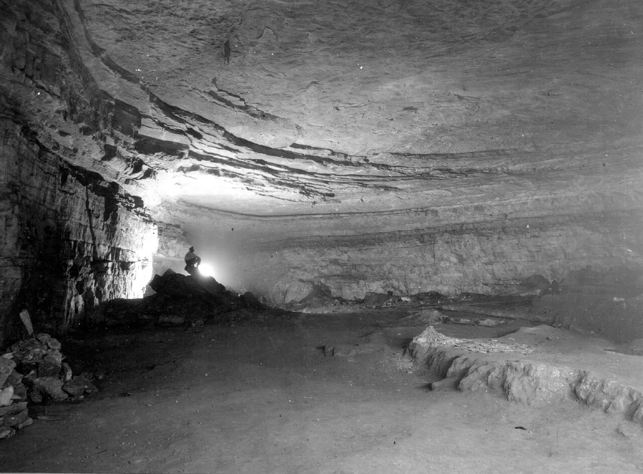
Mammoth Cave Rotunda (USGS Lwt02830), Mammoth Cave National Park

Get out of town

Day trips from Murfreesboro

19 nearby parks, towns and places to explore, ordered by straight-line distance.

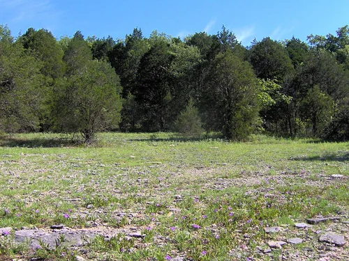
Cedar glade col tn, Cedars of Lebanon State ParkState park

Cedars of Lebanon State Park

16 miles north · straight-line distance

State park in Tennessee, United States.

Confirm the visitor entrance, hours, reservations, access and seasonal conditions. Islands or water destinations may require different transport.
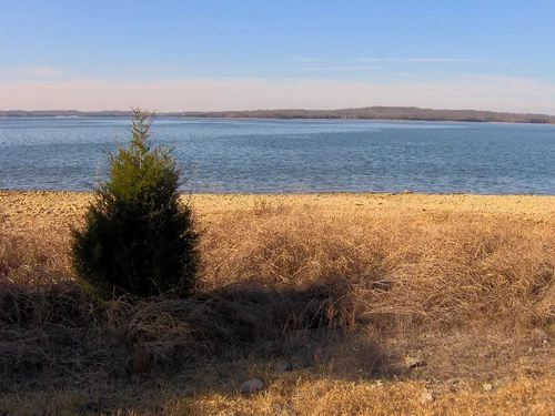
Percy priest lake tn, Long Hunter State ParkState park

Long Hunter State Park

19 miles northwest · straight-line distance

State park in Tennessee, United States.

Confirm the visitor entrance, hours, reservations, access and seasonal conditions. Islands or water destinations may require different transport.
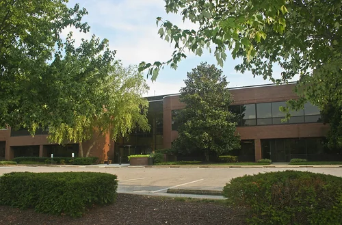
Shelbyville TennesseeTown

Shelbyville

25 miles south · straight-line distanceAbout 30 min by car (26 road miles, typical traffic, checked October 2026)

City in Bedford County, Tennessee, United States.

Confirm the visitor entrance, hours, reservations, access and seasonal conditions. Islands or water destinations may require different transport.
Things to do

Nashville Zoo at Grassmere

25 miles northwest · straight-line distanceAbout 30 min by car (28 road miles, typical traffic, checked October 2026)

Non-profit organization in Tennessee, US.

Confirm the visitor entrance, hours, reservations, access and seasonal conditions. Islands or water destinations may require different transport.
Brentwood Tennessee Town HallTown

Brentwood

25 miles northwest · straight-line distanceAbout 40 min by car (30 road miles, typical traffic, checked October 2026)

Suburb of Nashville, Tennessee, located in Williamson County, USA.

Confirm the visitor entrance, hours, reservations, access and seasonal conditions. Islands or water destinations may require different transport.
Town

Mt. Juliet

26 miles north · straight-line distanceAbout 35 min by car (35 road miles, typical traffic, checked October 2026)

City in Wilson County, Tennessee, United States; suburb of Nashville, Tennessee.

Confirm the visitor entrance, hours, reservations, access and seasonal conditions. Islands or water destinations may require different transport.
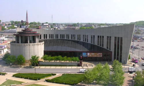
Country Music Hall of Fame and MuseumThings to do

Country Music Hall of Fame and Museum

30 miles northwest · straight-line distanceAbout 35 min by car (32 road miles, typical traffic, checked October 2026)

Hall of fame.

Confirm the visitor entrance, hours, reservations, access and seasonal conditions. Islands or water destinations may require different transport.
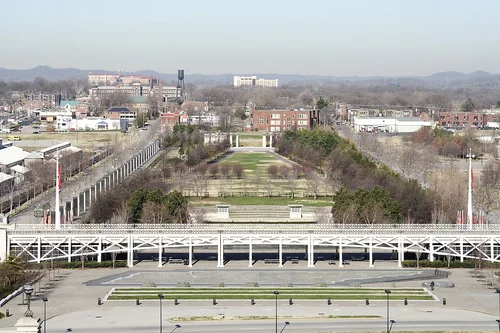
Bicentenial Capitol Mall Park, Bicentennial Mall State ParkState park

Bicentennial Mall State Park

32 miles northwest · straight-line distance

Urban state park in Nashville, Tennessee.

Confirm the visitor entrance, hours, reservations, access and seasonal conditions. Islands or water destinations may require different transport.
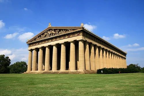
Parthenon, NashvilleThings to do

Parthenon

32 miles northwest · straight-line distanceAbout 35 min by car (36 road miles, typical traffic, checked October 2026)

Parthenon in Nashville.

Confirm the visitor entrance, hours, reservations, access and seasonal conditions. Islands or water destinations may require different transport.
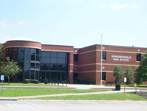
Hendersonville HighTown

Hendersonville

34 miles north · straight-line distanceAbout 50 min by car (49 road miles, typical traffic, checked October 2026)

City in Tennessee, United States.

Confirm the visitor entrance, hours, reservations, access and seasonal conditions. Islands or water destinations may require different transport.
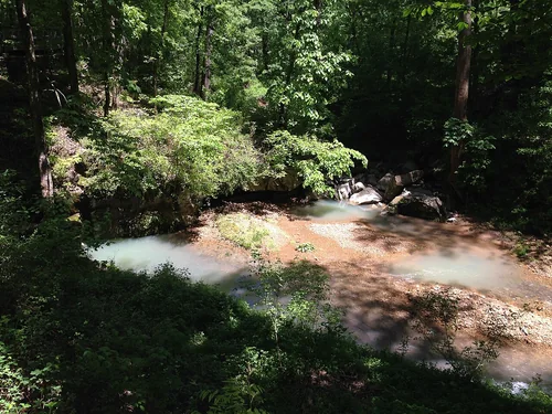
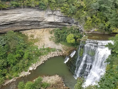
Burgess FallsOutdoors

Burgess Falls

47 miles east · straight-line distance

Waterfall in Tennessee, United States.

Confirm the visitor entrance, hours, reservations, access and seasonal conditions. Islands or water destinations may require different transport.
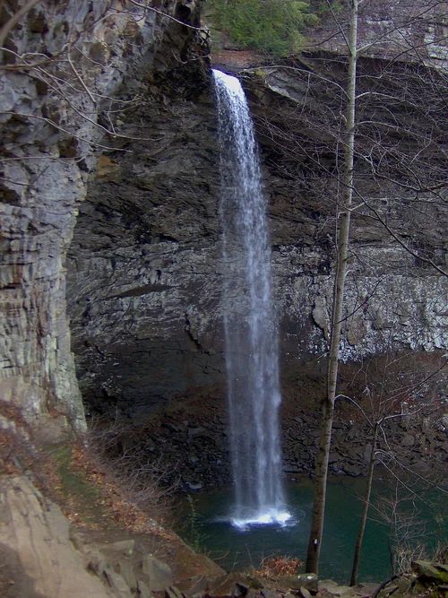
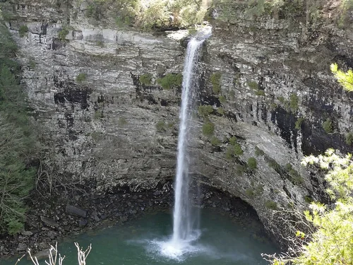
Rockhouse FallsOutdoors

Rockhouse Falls

60 miles east · straight-line distance

Waterfall.

Confirm the visitor entrance, hours, reservations, access and seasonal conditions. Islands or water destinations may require different transport.
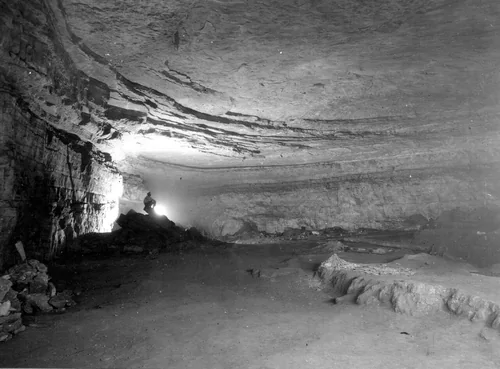
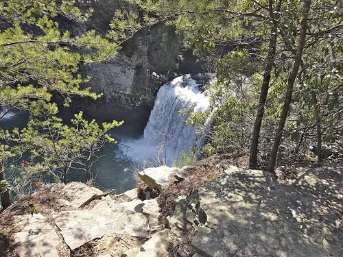
Cane Creek FallsOutdoors

Cane Creek Falls

60 miles east · straight-line distance

Waterfall.

Confirm the visitor entrance, hours, reservations, access and seasonal conditions. Islands or water destinations may require different transport.
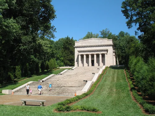
Spring in Russell Cave NM, Russell Cave National MonumentNational park site

Russell Cave National Monument

68 miles southeast · straight-line distance

310 acres in Alabama (US) managed by the National Park Service.

HikingHistoryWildlife viewingAgency site ↗

Confirm the visitor entrance, hours, reservations, access and seasonal conditions. Islands or water destinations may require different transport.

Town

Huntsville

79 miles south · straight-line distanceAbout 1 hr 40 min by car (84 road miles, typical traffic, checked October 2026)

County seat of Madison County, Alabama, United States.

Confirm the visitor entrance, hours, reservations, access and seasonal conditions. Islands or water destinations may require different transport.

Ozone FallsOutdoors

Ozone Falls

89 miles east · straight-line distance

Waterfall in Tennessee, United States.

Confirm the visitor entrance, hours, reservations, access and seasonal conditions. Islands or water destinations may require different transport.

Mammoth Cave Rotunda (USGS Lwt02830), Mammoth Cave National ParkNational park site

Mammoth Cave National Park

94 miles north · straight-line distance

U.S. national park in Kentucky.

BikingCampingFishingHikingHorse CampingHorseback ridingAgency site ↗

Confirm the visitor entrance, hours, reservations, access and seasonal conditions. Islands or water destinations may require different transport.

National park site

Manhattan Project National Historical Park

112 miles east · straight-line distance

Historic Park covering Manhattan Project infrastructure in New Mexico, Tennessee, and Washington.

Confirm the visitor entrance, hours, reservations, access and seasonal conditions. Islands or water destinations may require different transport.

Abraham Lincoln Birthplace National Historical ParkNational park site

Abraham Lincoln Birthplace National Historical Park

129 miles north · straight-line distance

U.S. National Historical Park.

Confirm the visitor entrance, hours, reservations, access and seasonal conditions. Islands or water destinations may require different transport.

Driving times are typical estimates from the city center without live traffic, Powered by Geoapify · © OpenStreetMap contributors.

Distances are measured in a straight line from the city, not by road. Some older drive-time estimates have no reliable date and do not reflect current traffic; routes to large parks or waterfronts may vary. Check the destination entrance before leaving. Place descriptions come from Wikidata. Photo credits include capture dates when available; photos may not show current conditions.

Outdoor places near Murfreesboro

40 recreation areas and campgrounds within 108 miles, from Recreation.gov. Filter by what you want to do.

Recreation area

Stones River National Battlefield

3 miles northwest · straight-line distanceNational Park Service

The Battle of Stones River began on the last day of 1862 and became one of the bloodiest conflicts of the Civil War.

BikingFishingHikingHistoryPicnickingWildlife viewing

Recreation area

Tennessee Civil War National Heritage Area

3 miles east · straight-line distanceNational Park Service

Experience the powerful stories of military conflict in a divided state, the demands of the homefront and occupation, the freedom of emancipation, and the enduring legacies of Reconstruction at sites across the entire state of Tennessee.

History

Campground

Jefferson Springs

12 miles northwest · straight-line distanceAbout 20 min by car (14 road miles, checked October 2026)US Army Corps of Engineers

Jefferson Springs Recreation Area is a lakeside oasis in the hills of middle Tennessee, providing visitors with countless recreational activities on the lake and the surrounding woods and grasslands.

BoatingCampingFishingHikingWildlife viewing

Campground

Poole Knobs

16 miles northwest · straight-line distanceAbout 35 min by car (23 road miles, checked October 2026)US Army Corps of Engineers

Poole Knobs Campground is a lakeside oasis in the green hills of Tennessee, providing campers with countless recreational activities on the lake and in the surrounding woods and grasslands.

BoatingCampingFishingHikingHorseback ridingWildlife viewing

Campground

Smith Springs

20 miles northwest · straight-line distanceAbout 35 min by car (28 road miles, checked October 2026)US Army Corps of Engineers

Smith Springs Recreation Area is a lakeside oasis in the hills of middle Tennessee, providing visitors with countless recreational activities on the lake and in the surrounding woods and grasslands.

BoatingCampingFishingPicnickingWildlife viewing

Campground

Anderson Road Campground

22 miles northwest · straight-line distanceAbout 30 min by car (28 road miles, checked October 2026)US Army Corps of Engineers

Anderson Road Campground is a lakeside oasis in the green hills of Tennessee, providing campers with countless recreational activities on the lake and in the surrounding woods and grasslands.

BoatingCampingFishingHikingSwimmingWildlife viewing

Campground

Seven Points (Tn)

22 miles northwest · straight-line distanceAbout 45 min by car (37 road miles, checked October 2026)US Army Corps of Engineers

Seven Points Campground is a lakeside oasis in the green hills of Tennessee, providing visitors with countless recreational activities on the lake and the surrounding miles of woods and grasslands.

BoatingCampingCanoeingFishingHikingKayakingSwimmingWildlife viewing

Campground

Cook Day Use Area

23 miles northwest · straight-line distanceAbout 45 min by car (38 road miles, checked October 2026)US Army Corps of Engineers

Cook Day Use Area is a lakeside oasis in the hills of middle Tennessee, providing visitors with countless recreational activities on the lake and in the surrounding woods and grasslands.

BoatingCampingHikingPicnickingSwimmingWildlife viewing

Recreation area

J Percy Priest Lake

25 miles northwest · straight-line distanceUS Army Corps of Engineers

The Nashville District U.S. Army Corps of Engineers welcomes you to J. Percy Priest Lake. The lake provides a variety of outdoor recreational opportunities for millions of visitors each year.

BikingBoatingCampingFishingHikingHorseback ridingHotel/Lodge/Resort Privately OwnedNature education

Campground

Shutes Branch

29 miles north · straight-line distanceAbout 50 min by car (39 road miles, checked October 2026)US Army Corps of Engineers

Shutes Branch is located on the popular Old Hickory Lake, just a short drive outside of Nashville. There's plenty of opportunities for boating, biking, swimming and fishing, as well as sailing.

BikingBoatingCampingFishingHikingKayakingPaddle BoatingPicnicking

Campground

Cedar Creek (Tn)

30 miles north · straight-line distanceAbout 45 min by car (40 road miles, checked October 2026)US Army Corps of Engineers

Cedar Creek Campground on Old Hickory Lake in north-central Tennessee, offers 60 campsites and limitless options for activities like boating, hiking, fishing and relaxing on the swim beach.

BoatingCampingFishingSwimming

Campground

Laguardo

31 miles north · straight-line distanceAbout 40 min by car (34 road miles, checked October 2026)US Army Corps of Engineers

Not far from Nashville, Laguardo is a great day-trip destination for kids and families. It offers a playground, boat ramp, and sandy beach to keep both the kids and adults entertained.

BoatingCampingCanoeingFishingKayakingSwimming

Campground

Lone Branch

31 miles north · straight-line distanceAbout 45 min by car (38 road miles, checked October 2026)US Army Corps of Engineers

Lone Branch offers all the amenities visitors need for a peaceful Tennessee getaway. Plenty of trees to provide shade, grassy open areas to run around, grills for barbequing and a boat ramp.

BoatingCampingPicnicking

Campground

Cages Bend

32 miles north · straight-line distanceAbout 55 min by car (49 road miles, checked October 2026)US Army Corps of Engineers

Cages Bend Campground is located on the shores of Old Hickory Lake, offering campers the opportunity to enjoy activities with a beautiful scenic backdrop.

BoatingCampingFishing

Recreation area

Old Hickory Lake

33 miles north · straight-line distanceUS Army Corps of Engineers

Old Hickory Lake is a popular recreation destination and ranks third in Corps-wide visitation. Lakefront property is in great demand.

BikingBoatingCampingFishingHikingHistoryHotel/Lodge/Resort Privately OwnedPicnicking

Campground

Avondale

34 miles north · straight-line distanceAbout 55 min by car (48 road miles, checked October 2026)US Army Corps of Engineers

Avondale is a wonderful destination for people looking to launch a boat or have a picnic. Visitors can bring their family and friends for water sports and plenty of sunshine. The boat launch area at Avondale is open year-round.

BoatingCampingCanoeingFishingKayakingPicnickingWater Access

Campground

Old Hickory Beach

34 miles northwest · straight-line distanceAbout 50 min by car (44 road miles, checked October 2026)US Army Corps of Engineers

Old Hickory Beach sits along the lengthy shoreline of Old Hickory Lake. The day-use area is perfect for visitors looking to spend a day on the lake or lounging on the beach.

CampingFishingHikingSwimming

Campground

Rockland Recreation Area

34 miles northwest · straight-line distanceAbout 50 min by car (48 road miles, checked October 2026)US Army Corps of Engineers

Rockland Recreation Area is located on the shore of Old Hickory Lake in Hendersonville, Tennessee. Old Hickory Lake was created by the Army Corps of Engineers on the Cumberland River.

ArcheryBoatingCampingFishingPicnicking

Campground

Nat Caldwell Park

35 miles north · straight-line distanceAbout 50 min by car (45 road miles, checked October 2026)US Army Corps of Engineers

Nat Caldwell Park is located right off of US-31E/Nashville Pike. This park is an ideal place for a day of picnicking and other outdoor activities.

CampingCanoeingFishingKayakingPicnicking

Campground

Center Hill Lake Primitive Camping Areas

36 miles northeast · straight-line distanceAbout 1 hr 5 min by car (47 road miles, checked October 2026)US Army Corps of Engineers

Center Hill Lake Primitive Camping is a unique camping experience at designated areas across Center Hill's 415 miles of shoreline. Primitive camping offers a unique rustic lake front camping experience.

BackpackingBirdingBoatingCampingCanoeingFishingHikingHunting

Recreation area

Center Hill Lake

37 miles northeast · straight-line distanceUS Army Corps of Engineers

Facilities located at Center Hill Lake include Edgar Evins State Park and the Joe L. Evins Appalachian Center for Crafts. Burgess Falls State Natural Area and Rock Island State Park are also located on the lake.

BikingBoatingCampingFishingHikingHistoryHotel/Lodge/Resort Privately OwnedNature education

Recreation area

Cordell Hull Lake

40 miles northeast · straight-line distanceUS Army Corps of Engineers

Visitors to Cordell Hull Lake enjoy a wide variety of recreational activities. The Tennessee Wildlife Resources Agency, under license to the Corps, administers an intensive wildlife management program at the lake.

BikingBoatingCampingFishingHikingHotel/Lodge/Resort Privately OwnedNature educationPicnicking

Recreation area

Cheatham Lock and Dam

57 miles northwest · straight-line distanceUS Army Corps of Engineers

Visitors to Cheatham Lake come to enjoy its many recreational opportunities. The Tennessee Wildlife Resources Agency manages wildlife management areas on the lake.

BoatingCampingFishingHikingPicnickingWater sportsWildlife viewing

Recreation area

Russell Cave National Monument

68 miles southeast · straight-line distanceNational Park Service

Russell Cave National Monument is an archeological site with one of the most complete records of prehistoric cultures in the Southeast.

HikingHistoryWildlife viewing

Recreation area

Dale Hollow Lake

71 miles northeast · straight-line distanceUS Army Corps of Engineers

Dale Hollow Lake is a vacation destination that borders the Tennessee-Kentucky state line. Dale Hollow Dam and Lake was completed in 1943.

BikingBoatingCampingFishingHikingHistoryHorseback ridingHotel/Lodge/Resort Privately Owned

Recreation area

Barren River Lake

74 miles north · straight-line distanceUS Army Corps of Engineers

The Barren River was the historic route for westward traveling pioneers. They would travel down the Barren River to a trading post at present-day Bowling Green, Kentucky, where their journey would proceed by land.

BoatingCampingFishingHikingHotel/Lodge/Resort Privately OwnedNature educationPicnickingWater sports

Recreation area

Fern Cave National Wildlife Refuge

81 miles south · straight-line distanceFish and Wildlife Service

Fern Cave National Wildlife Refuge, established in 1981, consists of 199 acres of forested hillside underlain by a massive cave with many stalactite and stalagmite-filled rooms.

HikingPhotographyWildlife viewing

Recreation area

Sauta Cave National Wildlife Refuge

86 miles south · straight-line distanceFish and Wildlife Service

Sauta Cave National Wildlife Refuge, known as Blowing Wind Cave NWR until 1999, lies just above the Sauty Creek embayment of TVA’s Guntersville Reservoir, seven miles west of Scottsboro, Jackson County, Alabama.

HuntingPhotographyWildlife viewing

Recreation area

Chickamauga & Chattanooga National Military Park

88 miles southeast · straight-line distanceNational Park Service

In 1863, Union and Confederate forces fought for control of Chattanooga - a gateway to the Confederacy. The Confederates were victorious at nearby Chickamauga in September.

BikingClimbingHikingHistoryHorseback ridingPaddlingPicnicking

Recreation area

Cross Creeks National Wildlife Refuge

90 miles northwest · straight-line distanceFish and Wildlife Service

Established on Nov. 9, 1962, Cross Creeks National Wildlife Refuge lies within the floodplain of the Cumberland River which is now Barkley Lake. The refuge was established as a result of mitigation proceedings with the U.S.

ArcheryBikingBirdingBoatingFishingHorseback ridingHuntingMotor Boat

Recreation area

Mammoth Cave National Park

94 miles north · straight-line distanceNational Park Service

Rolling hills, deep river valleys, and the world's longest known cave system. Mammoth Cave National Park is home to thousands of years of human history and a rich diversity of plant and animal life, earning it the title of UNESCO World…

BikingCampingFishingHikingHorse CampingHorseback ridingPaddlingSwimming

Recreation area

Wheeler National Wildlife Refuge

95 miles south · straight-line distanceFish and Wildlife Service

Wheeler National Wildlife Refuge was established on July 7, 1938 by President Franklin D. Roosevelt as a refuge and breeding ground for migratory birds and other wildlife.

BikingBirdingBoatingFishingHikingHorseback ridingHuntingMotor Boat

Recreation area

Fort Donelson National Battlefield

96 miles northwest · straight-line distanceNational Park Service

"Fort Donelson will hereafter be marked in Capitals on the maps of our United Country..." Brigadier General Ulysses S.

BikingHikingHistoryWildlife viewing

Recreation area

Cherokee National Forest

98 miles southeast · straight-line distanceUSDA Forest Service

BikingBoatingCampingFire Lookouts/Cabins OvernightFishingHikingHorse CampingHorseback riding

Recreation area

Nolin River Lake

99 miles north · straight-line distanceUS Army Corps of Engineers

Nolin River Lake has an average annual visitation of over two million and maintains one of the lowest drowning rates in the State.

BikingBoatingCampingFishingHikingHotel/Lodge/Resort Privately OwnedNature educationPicnicking

Recreation area

Muscle Shoals National Heritage Area

101 miles southwest · straight-line distanceNational Park Service

The Tennessee River brought the early Native Americans and then the European settlers. For years, it frustrated those who tried to cross it or tame it. Men fought from its banks and others found power from its waters. It created a culture.

BikingFishingHistoryWildlife viewing

Recreation area

Obed Wild & Scenic River

102 miles east · straight-line distanceNational Park Service

The Obed Wild and Scenic River looks much the same today as it did when the first white settlers strolled its banks in the late 1700s.

CampingClimbingFishingHikingPaddlingWildlife viewing

Recreation area

Tennessee National Wildlife Refuge

102 miles west · straight-line distanceFish and Wildlife Service

Located on and around Kentucky Lake in Northwest Tennessee, the refuge’s three units, Big Sandy, Duck River, and Busseltown, stretch for 65 miles along the Tennessee River.

ArcheryBikingBirdingBoatingFishingHikingHorseback ridingHunting

Recreation area

Big South Fork National River & Recreation Area

107 miles northeast · straight-line distanceNational Park Service

Encompassing 125,000 acres of the Cumberland Plateau, Big South Fork National River and Recreation Area protects the free-flowing Big South Fork of the Cumberland River and its tributaries.

BikingBoatingCampingClimbingFishingHikingHistoryHorse Camping

Recreation area

Little River Canyon National Preserve

108 miles southeast · straight-line distanceNational Park Service

Little River is unique because it flows for most of its length atop Lookout Mountain in northeast Alabama.

BikingClimbingFishingHikingHorseback ridingHuntingPaddlingPicnicking

Recreation areas and campgrounds from Recreation.gov's directory, checked October 9, 2026. Listings are not live availability: check Recreation.gov or the managing agency for open dates, fees, reservations and conditions. Directions go to the listed coordinates, which may not be the entrance. Campground driving times: Powered by Geoapify · © OpenStreetMap contributors.

Questions

What day-trip ideas are near Murfreesboro?

This guide includes Cedars of Lebanon State Park, Long Hunter State Park, Shelbyville, Nashville Zoo at Grassmere, Brentwood. Places are ordered by straight-line distance. Confirm visitor access, opening hours and current travel conditions before choosing a trip.

How far is Cedars of Lebanon State Park from Murfreesboro?

Approximately 16 miles north in a straight line. This is not current traffic or a route to a confirmed visitor entrance. Check your route before leaving.

How far is Long Hunter State Park from Murfreesboro?

Approximately 19 miles northwest in a straight line. This is not current traffic or a route to a confirmed visitor entrance. Check your route before leaving.

How far is Shelbyville from Murfreesboro?

Approximately 25 miles south in a straight line; driving takes about 30 min over 26 road miles in typical traffic (Geoapify, checked October 2026). This is not current traffic or a route to a confirmed visitor entrance. Check your route before leaving.

Where can I camp near Murfreesboro?

Recreation.gov lists 16 campgrounds within 36 miles, including Jefferson Springs (12 miles northwest), Poole Knobs (16 miles northwest), Smith Springs (20 miles northwest). Check Recreation.gov for current availability, seasons and reservations.

Murfreesboro AI

Your Murfreesboro local guide
Hey there!

I'm Murfreesboro AI. Ask about neighborhood food, independent shops, local history or planning a visit.

AI recommendations may be inaccurate. Verify hours and prices. Questions are processed by Cloudflare. Privacy