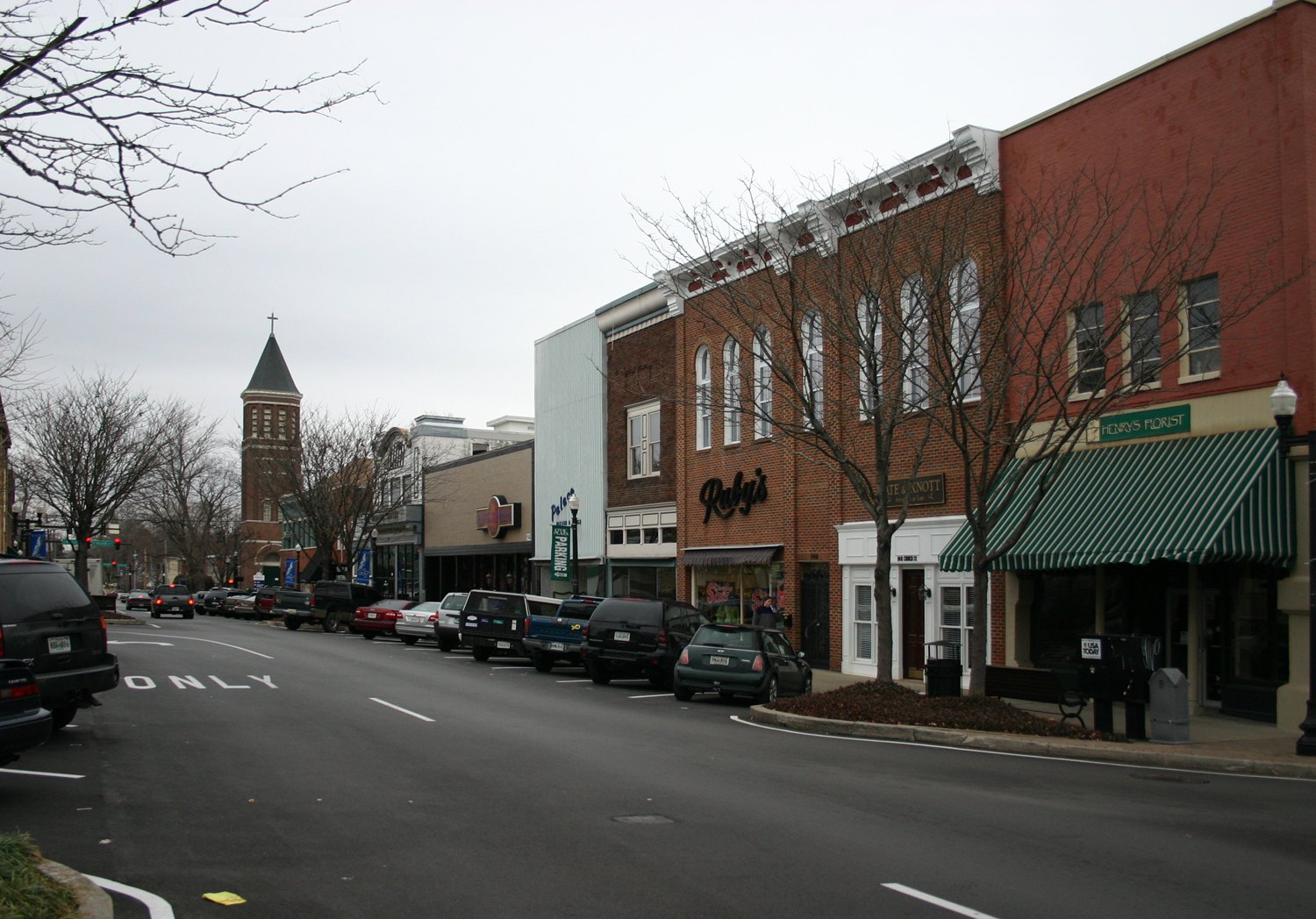
Historic downtown Murfreesboro

Outdoors

Swimming holes and lakes near Murfreesboro

Lakes, rivers and beaches near Murfreesboro where swimming is allowed on public land.

11places to swim
22 mito the closest
5within 30 miles
May–Septemberbest months

Good to know: Most natural swimming areas have no lifeguard; check water-quality advisories and current conditions before swimming.

Closest picks

1

Anderson Road Campground

22 mi northwest · US Army Corps of Engineers

Anderson Road Campground is a lakeside oasis in the green hills of Tennessee, providing campers with countless recreational activities on the lake and in the surrounding woods and grasslands.

2

Seven Points (Tn)

22 mi northwest · US Army Corps of Engineers

Seven Points Campground is a lakeside oasis in the green hills of Tennessee, providing visitors with countless recreational activities on the lake and the surrounding miles of woods and grasslands.

3

Cook Day Use Area

23 mi northwest · US Army Corps of Engineers

Cook Day Use Area is a lakeside oasis in the hills of middle Tennessee, providing visitors with countless recreational activities on the lake and in the surrounding woods and grasslands.

Map of all 11 places

Map of 11 places loads as you scroll.

Within 30 miles (5)

22 mi northwest · US Army Corps of Engineers · Campground

Anderson Road Campground

Anderson Road Campground is a lakeside oasis in the green hills of Tennessee, providing campers with countless recreational activities on the lake and in the surrounding woods and grasslands.

  • Boating
  • Camping
  • Fishing
  • Hiking
  • Swimming
  • Wildlife viewing

22 mi northwest · US Army Corps of Engineers · Campground

Seven Points (Tn)

Seven Points Campground is a lakeside oasis in the green hills of Tennessee, providing visitors with countless recreational activities on the lake and the surrounding miles of woods and grasslands.

  • Boating
  • Camping
  • Canoeing
  • Fishing
  • Hiking
  • Kayaking
  • Swimming
  • Wildlife viewing

23 mi northwest · US Army Corps of Engineers · Campground

Cook Day Use Area

Cook Day Use Area is a lakeside oasis in the hills of middle Tennessee, providing visitors with countless recreational activities on the lake and in the surrounding woods and grasslands.

  • Boating
  • Camping
  • Hiking
  • Picnicking
  • Swimming
  • Wildlife viewing

25 mi northwest · US Army Corps of Engineers

J Percy Priest Lake

The Nashville District U.S. Army Corps of Engineers welcomes you to J. Percy Priest Lake. The lake provides a variety of outdoor recreational opportunities for millions of visitors each year.

  • Biking
  • Boating
  • Camping
  • Fishing
  • Hiking
  • Horseback riding
  • Hotel/Lodge/Resort Privately Owned
  • Nature education

30 mi north · US Army Corps of Engineers · Campground

Cedar Creek (Tn)

Cedar Creek Campground on Old Hickory Lake in north-central Tennessee, offers 60 campsites and limitless options for activities like boating, hiking, fishing and relaxing on the swim beach.

  • Boating
  • Camping
  • Fishing
  • Swimming

30 to 75 miles (2)

31 mi north · US Army Corps of Engineers · Campground

Laguardo

Not far from Nashville, Laguardo is a great day-trip destination for kids and families. It offers a playground, boat ramp, and sandy beach to keep both the kids and adults entertained.

  • Boating
  • Camping
  • Canoeing
  • Fishing
  • Kayaking
  • Swimming

34 mi northwest · US Army Corps of Engineers · Campground

Old Hickory Beach

Old Hickory Beach sits along the lengthy shoreline of Old Hickory Lake. The day-use area is perfect for visitors looking to spend a day on the lake or lounging on the beach.

  • Camping
  • Fishing
  • Hiking
  • Swimming

75 miles and farther (4)

94 mi north · National Park Service

Mammoth Cave National Park

Rolling hills, deep river valleys, and the world's longest known cave system. Mammoth Cave National Park is home to thousands of years of human history and a rich diversity of plant and animal life, earning it the title of UNESCO World…

  • Biking
  • Camping
  • Fishing
  • Hiking
  • Horse Camping
  • Horseback riding
  • Paddling
  • Swimming

98 mi southeast · USDA Forest Service

Cherokee National Forest

  • Biking
  • Boating
  • Camping
  • Fire Lookouts/Cabins Overnight
  • Fishing
  • Hiking
  • Horse Camping
  • Horseback riding

107 mi northeast · National Park Service

Big South Fork National River & Recreation Area

Encompassing 125,000 acres of the Cumberland Plateau, Big South Fork National River and Recreation Area protects the free-flowing Big South Fork of the Cumberland River and its tributaries.

  • Biking
  • Boating
  • Camping
  • Climbing
  • Fishing
  • Hiking
  • History
  • Horse Camping

108 mi southeast · National Park Service

Little River Canyon National Preserve

Little River is unique because it flows for most of its length atop Lookout Mountain in northeast Alabama.

  • Biking
  • Climbing
  • Fishing
  • Hiking
  • Horseback riding
  • Hunting
  • Paddling
  • Picnicking

Distances are straight-line miles from downtown Murfreesboro. Listings come from Recreation.gov’s federal recreation database; check each official page for hours, fees, fire restrictions and closures before you go.

Get outside around Murfreesboro

5 THINGS TO DO NEAR 📍MURFREESBORO, TN video thumbnail

THINGS TO DO · YOUTUBE SHORT

5 THINGS TO DO NEAR 📍MURFREESBORO, TN

A local activity Short shared by MyLivability.

Watch on YouTube ↗

Around Murfreesboro

Allen Chapel A.M.E. Church, 224 S. Maney Ave, Murfreesboro
Allen Chapel A.M.E. ChurchSkye Marthaler · CC BY-SA 3.0
Rutherford Health Department, 303 N. Church St, Murfreesboro
Rutherford Health DepartmentSkye Marthaler · CC BY-SA 3.0
Closeup of Rutherford County Courthouse at Night, Murfreesboro
Closeup of Rutherford County Courthouse at NightJacob bloodaxe · CC BY-SA 4.0

More outdoors near Murfreesboro

Questions

Where is the closest place for swimming near Murfreesboro?

Anderson Road Campground (US Army Corps of Engineers), about 22 miles northwest of Murfreesboro as the crow flies. Next are Seven Points (Tn) (22 mi) and Cook Day Use Area (23 mi).

When is the best time for swimming near Murfreesboro?

Based on Murfreesboro’s average highs, May–September. Conditions at higher elevations can be much cooler.

Who manages these places?

Federal agencies including US Army Corps of Engineers, National Park Service, USDA Forest Service. Each listing links to its official page for hours, fees, closures and current conditions.

Murfreesboro AI

Your Murfreesboro local guide
Hey there!

I'm Murfreesboro AI. Ask about neighborhood food, independent shops, local history or planning a visit.

AI recommendations may be inaccurate. Verify hours and prices. Questions are processed by Cloudflare. Privacy